Building a Smarter
Network Planning and Management Tool
From scattered tools to streamlined optical cable
network management
From scattered tools to streamlined optical cable
network management
Team Telecom needed a unified solution to plan and manage optical cable networks more efficiently.
Previously, different tools were used in isolation - Google Earth and AutoCAD for mapping, and Excel for storing details. This fragmented process made planning and management time-consuming and prone to inefficiencies.
The challenge was clear: bring everything together into one smart system.
Fragmented workflows across multiple platforms created inefficiencies, errors, and barriers
to managing complex network infrastructure.
 Multiple tools required for different tasks
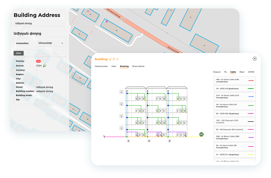
GIS mapping done separately in Google Earth and AutoCAD
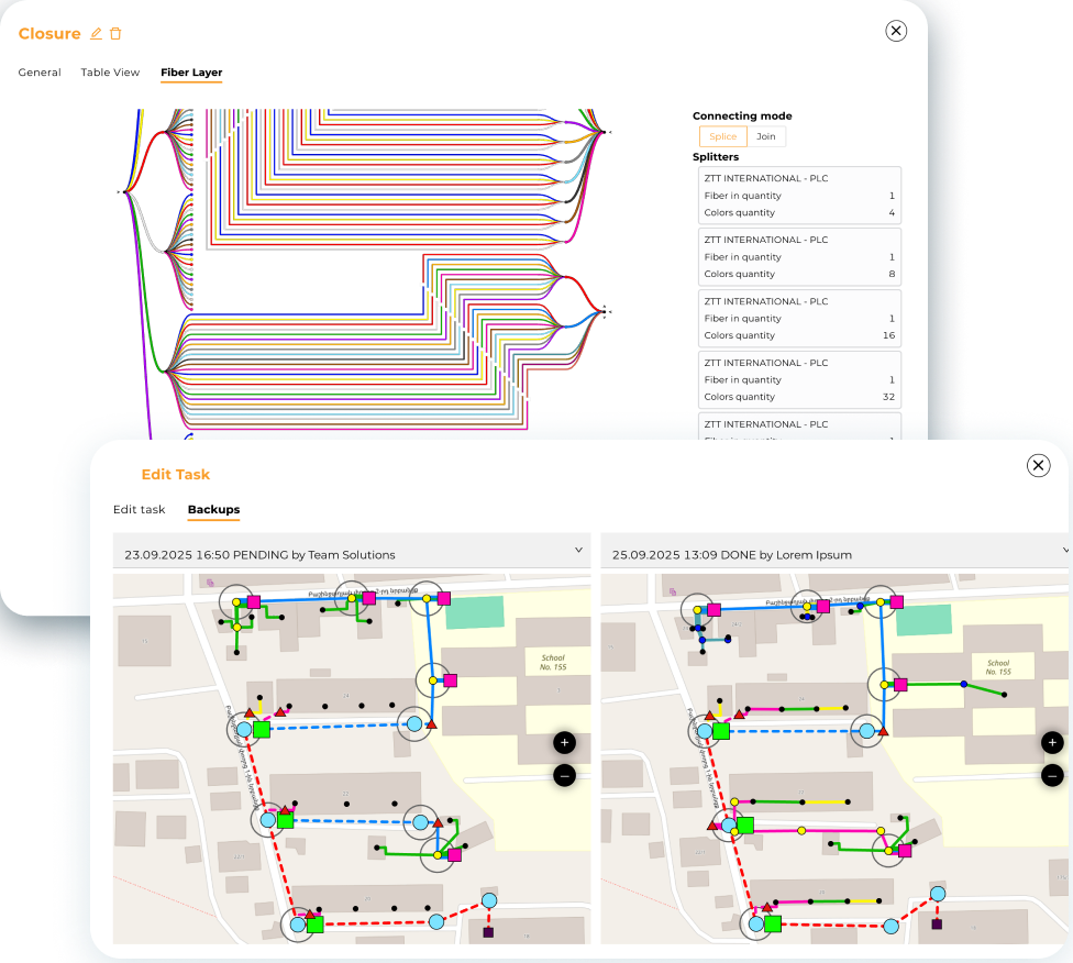
Splicing information scattered across Excel sheets
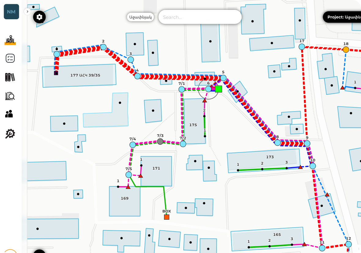
Objects in planning stage show on the map with little distinction
Difficulty in analyzing fiber paths and impacts of splices or cuts
Limited ability to scale and manage large, complex networks
Multiple tools required for different tasks
GIS mapping done separately in Google Earth and AutoCAD
Splicing information scattered across Excel sheets
Objects in planning stage show on the map with little distinction
Difficulty in analyzing fiber paths and impacts of splices or cuts
Limited ability to scale and manage large, complex networks
The development team designed and implemented a comprehensive platform that integrates mapping,
data storage, and fiber management in one place.
determine which connections are affected by a splice or cut
assess signal loss over long paths with accuracy
used address data + DBSCAN clustering to group unlabeled areas and match them with nearest settlements
integrated cadastre data with PostGIS to locate objects within specific communities
all network details in a single system
plan, coordinate, and track construction processes from start to finish
generate localized backups of specific areas to simplify task planning and execution
instantly trace the entire path of a fiber

 Reduced reliance on multiple external tools
Improved speed and accuracy in planning
Easier management of large-scale networks
More reliable operations for both internal teams and clients
Flexible foundation to add new features and scale further
Limited ability to scale and manage large, complex networks
Reduced reliance on multiple external tools
Improved speed and accuracy in planning
Easier management of large-scale networks
More reliable operations for both internal teams and clients
Flexible foundation to add new features and scale further
Limited ability to scale and manage large, complex networks
By consolidating fragmented tools into one Network Planning Tool, the team delivered
a platform that makes telecom infrastructure planning smarter, faster, and more reliable.
Company